
WP's HP: HOME
| Bike: Bike Tour
Tips ~ [Cycle
Around The Noris] | ?Help? | Deutsch
Emitted latest changes I discovered.
2009/10: Along the Regnitz Valley Route between Fürth and Stadeln extensive duct works were and are in progress. One can expect a spaciously reconstructed cycle track.
2010: The gravel high route between Stöppach and Großvierberg is refurbished.
2010: A short but nice connection of the Pegnitz Valley Cycle Route to the 5-Flüsse-Radweg (Engl: 5 Streams Cycle Route)southeast of Hohenstadt avoids the use of the road. A brook bridge after the federal road B14 junction offers the connection to the new roundabout.
2010: A new cycle track from Lauf to Altdorf is under construction. Over Diepersdorf, Leinburg and Winn. (At the crossing to Schönberg/Himmelgarten all the money is spent at the moment.)
2010: A new cycle track from Nuremberg Zollhaus to Wendelstein is under construction.
2010: The blue bar forest path from Rummelsberg to Altenthann is new graveled an repaired.
2010: The blue dot forest path from (Ober-) Lindelburg to Pyrbaum is partly new graveled. Unfortunately unconsolidated.
2010: The road between Algersdorf and Stöppach is broadened and newly routed with a cycle track.
2010/11: The bridge over the Westtangente (Engl.: ~ western bypass) near the S-Bahn station Lauf-West is completely closed for repair work. Update: Since beginning of June 2011 it is open again.
2011: Between Pilsach and Pfeffertshofen the Laaber Valley Track (Neumarkt - Regensburg) is reconstructed with tar.
2011: The winter / spring flood has partly harmed the gravel paths along the river Pegnitz from Behringersdorf to the Wöhrder See. The damages, however, are repaired. Now the complete section from Hammer to the tar section at the Langeseebad (i.e public bath near Nuremberg-Erlenstegen) is sanded.
2011: Parallel to the southern connecting road between Röthenbach bei St. Wolfgang and Wendelstein there runs a tarred cycle track now.
2011: The tarred forest road from Heroldsberg to the connection road Güntersbühl-Behringersdorf has received a new tar layer.
2011: Around Lauf-Simmelsdorf numerous forest and dirt roads are newly graveled. Partly rather roughly.
2011: The path around the Kleiner Birkensee (Engl.: Small Birch Tree Lake) is completely reconstructed and (finely) graveled.
2011: The gap in the cycle track along the road from Lauf to Güntersbühl is to be closed during the year.
2008-11: Because the S-Bahn Nuremberg - Lauf links der Pegnitz is extended to Hartmannshof certain restrictions on sections of the 5 Streams Cycle Route close to the railroad line are possible.
2010/12: At Oberbürg (Nuremberg-Laufamholz) the bridge over the Pegnitz was foreseen to be rebuilt in October 2010. Update: But until begin of 2012 nothing has happened yet and it doesn't look as if something would occur soon.
2011/12: The 5 Streams Cycle Route is been expanded. Between Oed
and Lehenhammer a separate path is built.
In the section alongside the S-Bahn between Ottensoos and
Henfenfeld the new, slick tar surface can turn rather slippery. In
the hills the lane is often surprisingly wet.
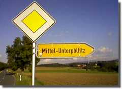
Where I am? Where to go?
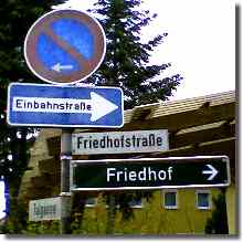
Some paths may be dangerous ...
Enjoy here in [Bike
Tours] some own bike tour tips
suitable for recumbents and therefore for touring as well.
For all the muscle heroes: The long ramp from Behringersmühle up
to Gößweinstein with its 18% is just well-known. But there is more
to find: From Kirchensittenbach up to Stöppach long sweat-spilling
22%.
When not stated otherwise the tours here are to use with normal
bikes as well. They are selected for people who also have an eye
for nature and who need not always leave their trails everywhere.
Therefore there is e.g. MTB downhill with lift in Osternohe.
By all means pay attention to
the nature reserves and protected landscape, please.
And to nature in general.
To map material and info:
Links
Easily in most cases you can combine the tours. For
orientation use a map for walking-tours scale 1:50 000 before
or the Bayern Viewer, refer to the link on the left. (I prefer them
instead of being depending on GPS and navigation system even on
bike as well. And one gets a better orientation and impression what
is in the surroundings.)
What the 5-Flüsse-Radweg (Five or 5 Streams Cycle Route) is for
tourers, the Anton-Leidinger-Weg (Weg, Engl.: path) is for MTB. The
feeder and a nice tour as well.
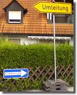
but there is always a way!
Anton-Leidinger-Weg: Walking path from Nuremberg Zoo through the Reichswald over the Moritzberg through the Birgland and over Poppberg to Amberg. Signed with blue bar exciting 71 km (45 miles) long!
Behringersdorf - Heroldsberg: Starting at Behringersdorf west of the lake Behringersdorferweiher (Weiher, Engl.: pond; path to the bridge over the freeway A3) with green bar over the range of hills to Heroldsberg. Passing spring Haidbrunnen and the Indianerspielplatz (Engl.: Indian playground). Steep at the ridge and demanding. (But one can bypass it ;-)
Hilly tour in the Birgland: Starting at Regelsmühle south of Thalheim (Mühle, Engl.: mill) over the Claramühle to the Kirchthalmühle and ahead to Troßalter (red point), from there passing the rock Bärenfelsen to Fürnried and further to the castle ruin Lichtenegg. Something to climb, especially if one doesn't heading westward from Fürnried to Lichtenegg, but in eastern direction over Wurmrausch.
Bitterbachschlucht: (Schlucht, Engl.: canyon) from Lauf (public bath) to Nuschelberg. Start junction Eschenauerstraße/Am Bitterbach.
Brunn: With the Anton-Leidinger-Weg or one of its parallel paths from the Nuremberg Zoo up the hill of Brunn and to a bath in the lake Birkensee.
Buchenbühl - Heroldsberg - Kalchreuth: North of the federal road B2, marked with blue cross over the railroad to the forest road to Heroldsberg. Then proceed with sun symbol crossing the forest road to Kalchreuth. Then proceed with red dot crossing the road Neunhof - Kalchreuth to the path with yellow dot. Either proceed with red dot or follow yellow dot left to a star shaped crossing. There turn right and proceed with yellow ring. (After the downhill just about 100 m left on the path there is the spring Tropfender Fels.) Then blue bar. At the Sambachweiher (Weiher, Engl.; pond) both routes meet again. Proceed with red dot to the road Kalchreuth - Neunkirchen.
Edelweißhütte: From Henfenfeld to Engelthal (yellow cross, path through meadows along the brook Hammerbach). Proceed to Kruppach and from there to the Edelweißhütte (Hütte, Engl.: lodge). Perhaps proceed to the Arzberg with viewing tower and from there to the upper basin of the Happurger Stausee (Engl.: reservoir).
From Eschenbach closely passing Hubmersberg to Hohenstadt with sign deer.
Feucht - Moosbach: Starting near the animals' home in Feucht with green dot to the shooting association in Moosbach. Passing the spring Hubertusbrunnen.
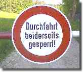
Really valid for MTB?
Förrenbach - Thalheim (green cross). Or on the road from Förrenbach over See (17%!) and Gotzendorf to Thalheim.
Glatzenstein - Hohenstein: From Speikern passing Leuzenberg to the rock Glatzensein (near Weißenbach). Proceed between Oberkrumbach and Morsbrunn with yellow cross. With red cross do not descent until Algersdorf, cross the road to Hormersdorf and upwards to Hohenstein. (Passing the decoration well close to this road.) Perhaps proceed over Treuf into the Pegnitz valley near Harnbach. Real steep, exciting views.
Hienberg inside(!) the freeway A9: From Schnaittach to Hedersdorf and proceeding underneath the bridges of the freeway A9. With yellow cross to Reingrub. Very demanding steep hollow-way.
Hersbruck - Hohenstein: Following the Main-Donau-Path from Hersbruck passing Kleedorf to Stöppach and proceeding to the castle Hohenstein. Exciting views.
Hersbruck (Weiher) - Edelweißhütte (Hütte, Engl.: lodge): With red dot and green 4 starting at the southwest edge of the town Hersbruck up the Franconian Jura. Very steep and demanding.
Hetzles: From Igensdorf with red bar (Westlicher Albrandweg; Engl.: Western Alb Seam Path) to the Hetzles and proceeding to Regensberg (close to a nature preserve!). Perhaps further over Mittelehrenbach, Dietzhof to the Walberla (official: Ehrenbürg). Partly very steep and very demanding.
Hirschbach: From Hirschbach northbound over the Windloch to Großmainfeld.
Höhenbach (Bach, Engl.: brook): From Rummelsberg with red dot up the brook to Altenthann. Demanding. Much more easier with blue bar.
Houbirg: From Pommelsbrunn to the Houbirg and to the rock Hohler Fels. Proceed to Arzlohe and over Mittelburg and Aicha to Heldmannsberg. From there a short distance on the road to Fürnried. In the valley turn right to the Regelsmühle.
Kainsbach valley: From Kainsbach near the Happurger Stausee
(Engl.: reservoir) upward over Mosenhof with path No 7 to
Hinterhaslach and proceed to Waller and perhaps to Traunfeld
(yellow dot) Through the protected landscape. Often wet.
Tip: At Hinterhaslach leave yellow dot by taking the path left
down in the valley, crossing the brook and then the next junction
to the right.
Kalchreuth: In the west of Kalchreuth at and near the Winterleite partly hard-core trails for specialists only.
Kipfental (Tal, Engl.: valley): From Lungsdorf (middle of the town) over Münzinghof to Viehofen or directly.
Klumpertal (Tal, Engl.: valley): From Schüttersmühle near Pottenstein to Bronn.
Krummes Tal (Engl.: Crooked Valley): From Kemmathen through the Krummes Tal (Großenohe, Spießmühle) downwards to the Trubach valley and then in the last third following the marking to Thuisbrunn (red bar).
Laufer Hüttenweg (Hütte, Engl.: lodge): From Lauf Station rechts der Pegnitz (Engl.: right of the Pegnitz) into the Fränkische Schweiz 33 km to Betzenstein. Passing the spring Gänsbrunnen. Sign DAV.
Lauterach: From Lauterach east of Kastl along the former railroad line Amberg - Lauterhofen to Amberg. There are just left three not reworked sections only. The Schweppermann Cycle Route Neumarkt - Amberg - Schwarzenfeld runs here. (2009 both meet near to Deinshof).
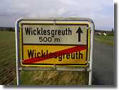
Just around the world
Lilling (nature reserve!): From Lilling passing the Lilling spring (also Lillach spring) to Weißennohe. Some alternatives including humping passage due to some stairs.
Max-Ettl-Weg (Weg, Engl.: path): From Röthenbach an der Pegnitz, S-Bahn station Seespitze 38 km to Lehenhammer through the Hersbrucker Schweiz passing Deckersberg and Arzlohe. Sign Edelweiss.
Molsberger valley (nature reserve!): From Föhrenbach near the Happurger Stausee /Engl.: reservoir) upward passing the sports field over Molsberg to Schupf or See. Already in the valley there is a branch to See with red dot and possible continuation to Thalheim.
Moritzberg: Numerous tours. For instance with blue cross from Röthenbach Main Station over Renzenhof and Haimendorf. Partly demanding and steep.
Nuremberg - Schnaittach: With red diagonal cross from Nuremberg-Erlenstegen East (at the railway bridge) passing the lake Weißensee through the forest Sebalder Reichswald passing the Rote Marter (Engl.: Red Stele) to Lauf. Passing the hill Kunigundenberg and again through the forest over Dehnberg and Höflas just close up to the brewery Wolfshöhe (directly east of the wooden bridge and before tunneling the freeway A9 turn north). The most demanding section through the canyon Röttenbachschlucht to Schnaittach.
Nuremberg - Tauchersreuth: With yellow cross from Nuremberg Turn und Taxisstraße (Nordostpark) passing the springs Teufelsbrunnen, Schusterbrunnen (Engl.: Shoemaker Spring): spring in the small valley in the forest area Saubühl. Just 150 m further on northeast of the Teufelsbrunnen), Haidbrunnen and Nesselbrunnen (Engl.: Nettle Spring: spring in the brook basin where the slope of the beaten path reaches the gravel path again; in the vicinity Widder, Engl.: hydraulic ram) northwest of Oedenberg-Simmelberg. Back with blue bar from Kleingeschaidt. Partly very demanding and steep.
Obertrubach to the castle ruin Leienfels. Start behind the boardinghouse Pension Maier.
Rounding Oedenberg: From Nuschelberg with yellow point to Günthersbühl. With blue cross over Oedenberg until the path with yellow cross. In the valley passing Simmelsberg and spring Nesselbrunnen with an hydraulic ram (German: Widder) on the left (excursion climbing up the hill with path No 2 to the right?) to Tauchersreuth. With green cross through Oedenberg on the street. In the valley leaving the road and proceed with green cross on gravel crossing the road to Heroldsberg. At the next junction turn left and cross the road Behringersdorf - Günthersbühl. At the next junction turn left and proceed with yellow point in front of Günthersbühl. Turn right until you meet blue point and cross with it the road Günthersbühl - Lauf and up again to Nuschelberg. There are extensions available, e.g. with yellow point to the Bitterbachschlucht (Schlucht, Engl.: canyon) or proceed with red cross to Lauf. Partly very steep and very demanding.
Ossinger: From Königstein over the Ossinger to the Zant and further to Mittelreinbach near Holnstein. (Easier to find in opposite direction with red dot and yellow dot, resp.)
Ottensoos - Weißenbrunn: Starting at Ottensoos Station with yellow dot over Rüblanden, Gersberg, passing Stierlbrunnen (calcareous karst spring) and Haidenloch (historical silver mine) to Entenberg and proceeding to Weißenbrunn. Perhaps additionally over Ernhofen to Unterwellitzleiten and Altdorf. Partly steep.
Paul Pfinziger Weg: Tour round Hersbruck, ca. 96 km, black PP on yellow ground with the approximate route Reichenschwand, Moritzberg, Klingenhof, Alfeld, Lichtenegg, Weigendorf, Bürtel, Pegnitz valley, Hohenstein, Oberkrumbach.
Pegnitz valley walking path (continuously signed with a stylized lion »Goldene Straße«, Engl.: Golden Road (runs 60 km from Nuremberg to Sulzbach-Rosenberg with further extension in direction Prague); original sign yellow bar, using the Paradiesweg, Engl.: Paradise Path as well): From Nuremberg-Erlenstegen East with the marking upward on the left side of the railroad bridge. Over the range of hills (Eichelberg) passing the spring Fuchsbrünnlein over the freeway A3 and passing the Behringersdorferweiher (Weiher, Engl.: pond) to Behringersdorf. Down to the river Pegnitz and with the Paradiesweg to Rückersdorf. At the group of trees in front of the town turn right and follow the path through the meadows to the road bridge over the Pegnitz, turn right and cross the bridge in direction Röthenbach and after the bridge just before reaching the first houses turn left heading for Lauf-Wetzendorf. Crossing the meadows of the Pegnitz to the sewage plant Lauf and up to the Bridge West. Partly demanding.
Pommelsbrunn: Passing the Naturfreundehaus (Engl.: ~ Nature Lover Lodge) to the castle ruin Lichtenstein and then with yellow cross and fawn to Hubmersberg. Partly very demanding and steep.
Rasch - Neumarkt: From Rasch with yellow bar through Rührersberg, Haslach and Kleinvoggenhof up the Dillberg. Carry on following yellow bar on the range of hills and down to Neumarkt. Nice views, but partly very steep and demanding.
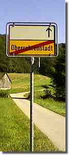
Road to Nowhere
Rohrenstadter (or Rohrenstädter) valley: Marked with blue cross from Hagenhausen near Altdorf over Stöckelsberg to Mitterrohrenstadt. Upward the valley to Deinschwang and further to Mettenhofen. Possible extension with green dot to Traunfeld. Partly very steep and demanding. Including brook transition, if one stays with red dot in the valley.
Röthenbachklamm - the classic (Klamm, Engl.: ravine; near a nature reserve!): From the lake Birkensee or later left of the path to Brunn (close to the Steinerne Brücke, Engl.: Stone Bridge) resp., along the brook Röthenbach over Ungelstetten with blue cross to Röthenbach near Altdorf.
Schnaittach: Numerous ponds in the forest between Lauf - Heuchling and Großbellhofen.
Schwarzachklamm (Klamm, Engl.: ravine): From Ochenbruck over Schwarzenbruck to the Bruckkanal (Old Canal). Proceed underneath the Bruckkanal bridge and the A9 freeway bridge to Nerreth and further to Wendelstein.
Schwarzachtal (Tal, Engl.: valley): From Rasch on the left or on the right side (stairs!) of the brook Schwarzach to Burgthann.
Signalstein: From Obertrubach over Hundsdorf to the rock Signalstein. Proceed with yellow cross to Hammermühle and further to Thuisbrunn. Providing something to climb.
Traunfelder Bach (Bach, Engl.: brook): From Unterrieden to the vicinity of front of Hagenhausen near Altdorf. Then upward through the valley to Traunfeld. One can either stay in the valley or use a small path at edge of the forest at the northern incline for a mountain trial to Eismannsberg (yellow dot). The Mauertsmühle you can only pass on the left side. Demanding and partly rather wet.
Wendelstein: At the eastern end of the town crossing the Old Canal northward up to the water reservoir and then left through the former stone pits, bridge the freeway A6 east of Worzeldorf and follow the marking yellow bar to the Hohlsteinbruch and then to the Steinbrüchlein (Engl.: little stone pit) and Nürnberg Zollhaus. Wild-romantic, partly demanding.
Some photos from the region:
Photo
Eager for water - it does not leave a good impression
when rumbling in an inn with the empty water bottle under ones arm,
to stumble to the WC and to disappear again after some time with
released smile, some belches and the full water bottle.
My tip for the fast tank stop: Usually nearly each larger village
in the region has a cemetery with potable water connection (often
marked by a church tower ,-). Only in the Rangau (around Ansbach)
one must pay attention, because there are often cisterns only. If
the water of a public well (tube) is not suitable for human
consumption, you will usually find the sign »Kein Trinkwasser«
(Engl.: No potable water).
Otherwise here a small selection of additional water places in the
Reichswald and its neighborhood. Privileged those which lie central
and are easy to reach by bike and are trustworthy as well. Many of
them are already tested by me (and obviously I have survived ;-) Of
course, I prefer those being clearly marked as suitable for human
beings. Due to liability reasons it is common to downgrade wells to
»Kein Trinwasser«.
Near Feucht (tubed, set to no potable water): through the inn at the Brückkanal follow the eastern forest path parallel to the Schwarzach; after ca. 500 m direct at the path
Grünbrünnlein (Engl.: Little Green Spring, not recommended!): waterhole close to the Old Canal near Schwarzenbruck. Follow the gravel road from Schwarzenbruck in direction Dürenhembach to the canal. At the first sluice house in direction Neumarkt (lock 49) cross the canal and follow the sanded path about 250 m (ca. 273 yards) into the forest. At the first junction turn left and then after ca. 25 m (ca. 27 yards) direct at the path.
Grünsberg (tubed): Dolderlesbrünnle (or Doktorlesbrünnle) and Sophienquelle at the footpath between Grünsberg and Reinholdshöhe; at the begin of the cycle track along the road to Burgthann choose the path into the forest on the right.
Haimendorf (tubed, standard potable water?): decoration well at the village passage in front of the fire station.
Hubertusbrunnen (tubed): about 500 m in the forest between Moosbach and Feucht railway station direct at the walking way marked with green circle; best approach starting at the Moosbacher rifle range and following the gravel path westbound into the forest and at the first crossing inside right; marked.
Kalter Brunnen (Engl.: Cold Spring) (spring): in the forest between Ungelstetten and Fischbach; coming on the road from Ungelstetten using the road tunneling the freeway A3, left on the road to Winkelhaid and at once right on the gravel way; after 200 m at the foot of the last incline before the way crossing 10 m right of the way.
Kemnath (tubed, standard potable water?): decoration wells in the middle of the town at the main street (Henger Straße) to (Postbauer-) Heng.
Mäbenberg (tubed, standard potable water?): decoration wells in the middle of the town at the church.
Maderersbrunnen (spring, not recommended): In Nuremberg-Brunn at the northwestern outskirts of the village. At the graveled forest path starting at the Maderersbrunnenstraße downhill after ca. 100 m follow the trial on the right for some ten meters.
Schmausenbuck, waterworks Nuremberg (tubed, standard potable
water?): on the tar road from the zoo to the children's playground
direction Schwaig; left passing the toboggan run and then uphill
the tarred way on the right to the reservoir; after about
100 m direct at the way.
(The spring »Buchenklinge« 500 m in the East is not
recommended, because it is not tubed).
Schwarzach Valley (tubed): halfway between Rasch and Prackenfels direct at the gravel path.
Schwarzenbruck (tubed, set to no potable water): at the beginning of the gravel road over the canal to Dürrenhembach ca. 25 m (ca 27 yards) on the right after the fairground at the end of the town.
Triebbrunnen (tubed, standard potable water): direct at the Cycle Route Reichswald - Rothsee in the middle between Harrlach and Guggenmühle close to the waterworks (from time to time drips only).
Ungelstetten (tubed, standard potable water?): decoration well in the middle of the village at the crossing.
Unterölsbach (tubed, standard potable water?): decoration well in the middle of the village at the junction to Gspannberg.
Between Wendelstein and Worzeldorf (spring): spring and decoration well direct at the gravel path No 1 continuing the street Treidelsweg in Wendelstein parallel north of the Old Canal half way to the pedestrian's bridge over the freeway A6.
Beerbach (tubed, standard potable water): decoration well in the
middle of the town.
Nikolausquelle (tubed, set to no potable water): at the
path between graveyard and Hirnstein (a stone as rest place) about
100 m north-east of the church.
Buchenbrunnen (Engl.: Beech Spring) (tubed): almost directly at the path between Rückersdorf-Ludwigshöhe and Nuschelberg with marking blue point; with bank for rest; marked. (Alternative: following marking yellow line eastward from the Schnackenbrunnen and then about 100 m blue point.
Hinterer (Engl.: Rear) and Vorderer (Engl.: Fore) Buchenbrunnen (both tubed): following marking green cross from »Rote Marter« (Engl.: Red Stele) to Behringersdorf. The Hinterer Buchbrunnen lies about 100 m left in the first hollow near the brook, follow the sign at the path, the Vordere Buchenbrunnen lies after the next crossing in the second hollow directly left of the path, signed »Buchenbrünnlein«, both refurbished and with rest occasion.
Bullach (tubed, standard potable water): decoration well in the middle of the town.
Dürerquelle (tubed): At the Sambachweiher (Sambach Ponds) near Kalchreuth follow marking red dot to south. After ca. 500 m you will find a sign at the gravel path.
Gänsbrunnen (Engl.: Gees(e) Spring; spring, not recommended!): at the Laufer Hüttenweg (sign: DAV) about 250 m west of the northern end of the pond of the same name south of Untersdorf near Schnaittach.
Hasensteinquelle (Engl.: Hare Stone Spring) (tubed): south-east of the former ammunition bunkers in the Buckenhofer Forst south of Weiher. On the approach path to the bunkers about 75 m west of the stone with the hare fresco after about 30 m beaten path to south.
Heroldsberg Haidbrunnen (tubed): in the clearing for the transmission line between Laufamholz and Heroldsberg at the ridge. At the end of the southern gravel path (yellow cross) follow or move back, resp. the left gravel path about 100 m to the west. At the great beech tree on the right uphill there are two tubed springs.
Heroldsberg Kneipp ground/fitness trail (tubed, standard potable water?): 100 m south-west of the forester ranch at the federal road B2.
Heroldsberg Teufelsbrunnen (Engl.: Devil's Spring) (tubed):
50 m away from the path marked with yellow cross and blue bar
over the first bridge across the freeway A3 south of the federal
road B2 between Nuremberg-Schafhof and Heroldsberg; about
500 m south east of the forester ranch. Follow the beaten path
at the bench in front of the forest area Saubühl. Just find this
sign at the crossing.
There is another Teufelsbrunnen between Heroldsberg and
Kleingescheid/Johannistal. Out of a sandstone formation with a
little red devil painted on a small spring spills out. The junction
to it is signed, however, it is more a path for walkers about
500 m into a small valley in the forest.
Kalchreuth Tropfender Fels (Engl.: Dripping Rock) (spring): natural sandstone formation about 750 m west by south-west of the Sambach-Weiher (Engl.: ponds). South of the ponds take the first junction to the west. Direct left of the way on half level around the hill (Winterleite); marked.
(Unterer, vorderer) Schnackenbrunnen (Engl.: Lower, Fore
Snail(?) Spring) (tubed): in the forest between Lauf and
Rückersdorf about 1.2 km from the fitness trail (west of the
public baths in Lauf) following the marking yellow line/blue cross
in western direction to »Rote Marter« (Engl.: ~ Red Stele); just
left after the shelter cabin right of the descent, marked.
(From the Schnackenbrunnen following the marking yellow line
eastwards one reaches after crossing the gravel path in a distance
of about 150 m the sign Hinterer (Engl.: Rear)
Schnackenbrunnen. Alternative: standing looking at the front of the
shelter cabin turn two times left. The spring is about
50 m down the hill to be reached on foot.
Following the northern path (= on the right) in front of the
shelter cabin one passes the marked Kreuzbrunnen (Engl.: Cross
Spring) is situated on right side just after the incline.)
Tauchersreuth (tubed, standard potable water?): decoration well at the edge of the town near the water tower at the road to Oedenberg.
Zellerbrunnen (tubed): in the forest between Rückersdorf and the road Behringersdorf - Günthersbühl; 150 m east of the road and parking place; marked.
Algersdorf (tubed, standard potable water?): decoration well at the red cross marked path to Hohenstein about 30 m east of the road Hersbruck to Hormersdorf.
Eckenricht near Edelsfeld (tubed, standard potable water?): decoration well in the middle of the town.
Engelthal (tubed, standard potable water): decoration well at the northern town border, direct at the cycle track to Henfenfeld.
Between Engelthal and Offenhausen (tubed, standard potable
water): direct at the cycle track at the road to Schrotsdorf.
Two additional ones just within Schrotsdorf.
Förrenbach (tubed, standard potable water?): each about 50 m west and south-east resp., of the church in the middle of the town.
Gersberg (tubed, set to no potable water): decoration well at the main street to Sendelbach.
Happurg (tubed, standard potable water?): decoration well at the town passage near the town hall.
Henfenfeld waterworks (tubed, standard potable water): direct at the cycle track along the railway line at the western border of the small town.
Hohenstadt (tubed, standard potable water?): decoration well at the main street in the western part of the town.
Hüttenbach (tubed): decoration well directly at the road to Oberwindsberg close to the top of the heavy slope.
Kucha (tubed, standard potable water?): decoration well at the main street in the middle of the town.
Lungsdorf (tubed): decoration well at the main street in the middle of the town.
Moritzberg (tubed): spring with sign at the Paul Pfinzinger Path at the north side of the mountain above Weigenhofen.
Mosenhof (tubed, standard potable water?): decoration well at the street (path No 7) parallel to the main road.
Oberviehberg (tubed, standard potable water): decoration well in the middle of the village.
Osternohe (tubed, standard potable water?): decoration wells in
the middle of the town at the main street and at the junction to
the Igelwirt (an inn).
In Haidling, direction Hormersdorf, another one.
Ottensoos (tubed, standard potable water): two decoration wells in the middle of the town, one in direction Lauf, one in direction Schönberg.
Püscheldorf (tubed, standard potable water?): decoration well in the middle of the village.
Rüblanden (tubed, standard potable water): decoration well in the middle of the village.
Rohrenstadter (or Rohrenstädter) Valley (tubed, standard potable water?): decoration wells at the main street in Mitterrohrenstadt and Oberrohrenstadt.
Sprosselbrunnen (spring): direct at the path green ring from Schönberg, western walking car park, to Haimendorf via the Klingender Wasserfall (Engl.: Sounding Waterfall).
Schnaittach Valley (tubed): between Speikern and Rollhofen close up the cycle track along the railway line at the beginning of Rollhofen.
Simmelsdorf (tubed, standard potable water?): decoration well at the main street vis-à-vis the service station in direction Schnaittach.
Thalheim (spring): direct at the road to Gotzenberg.
Traunfeld (spring): direct at the western edge of the town to the sewage plant at the valley path signed with yellow dot.
Vorra (tubed, standard potable water): decoration well just
south-west of the church in the middle of the town.
Two springs at the road to Stöppach in the incline section.
Ammerndorf (tubed, standard potable water): decoration well at the Bahnhofsplatz (Engl.: station square) about 35 m south of the Bibert Valley Cycle Route.
Fürth-Dambach (tubed, standard potable water): at the waterworks direct at the western Rednitz Valley Cycle Route between the Sieben-Bogen-Brücke (Engl.: Seven-Bow-Bridge) and Dambach.
Fürth-Espan (tubed, standard potable water): public lavatory at the Pegnitz Valley Cycle Route (closed during winter months).
Fürth-Loch (spring): left of the road between Oberweihersbuch and Loch, ca. 500 m in front of Loch.
Egloffstein Kneipp ground (tubed, standard potable water): at the northern end of the public baths, close up to the cycle track.
Gräfenberg (tubed, standard potable water?): decoration well in the old market.
Lilling (Lillach spring): in the forest between Oberkirch and Lilling.
Mittelehrenbach (tubed, standard potable water?): decoration well in the middle of the town.
Rüsselbach (tubed, standard potable water?): decoration well in the seating corner between Kirchrüsselbach and Oberrüsselbach.
Untertrubach (tubed, standard potable water?): close up to the crossing of the Trubach valley road and the connection road Untertrubach - Dörfles.
Entertainment tip - watch and take part: cycle race »Rund
um die Nürnberger Altstadt« (Engl.: Around the Nuremberg Old
Town).
Due to the doping scandals and the thereby caused spectator
decrease a new event in September 2011 was endangered. In a small
circle - to take literally: again as in the beginning 5 km
rounds around the old town wall - it has taken place after all.
Let's see what will happen in 2012.
©WP (1998 -) 2012
http://www.fen-net.de/walter.preiss/e/bike_nbg.html
Update: V8.4, 2012-03-02